Linking Pleiades to OpenStreetMap
I'm a Pleiades user as well as its developer, and I try to get coordinates from OpenStreetMap whenever I can for several reasons.
- Citing a specific OpenStreetMap entity, as http://pleiades.stoa.org/places/628932/summit cites http://www.openstreetmap.org/browse/node/100778739, makes a discoverable and actionable link between Pleiades and the world's foremost open spatial database.
- I'm an OpenStreetMap user too, and very interested in getting historical data into OSM. These are steps in that direction. The links I've made in Pleiades can be used someday in finding the appropriate OSM objects to improve using information from Pleiades.
- OpenStreetMap has editing tools far beyond anything that Pleiades can or will provide. See the new iD editor for example. I'd like to explore the possibilities of digitizing in OSM and then pulling coordinates back into Pleiades.
To make it easier for myself (and hopefully for others), I've added a new option to the familiar "Add Location" button on every place page. Click the downward caret on the right side of that button and a short form will be revealed. Type in the ID of a OpenStreetMap Node such as 100778739 for the entity mentioned above (only nodes, for now), an optional title (which also becomes the location's short name, a sensible default is produced if left blank), and click "Go."
The form's handler then makes a request to the OSM API, parses the response, and creates a new Pleiades location object with many fields already filled out for you: the title and description, the coordinates, the citation, the provenance – and best of all – the accuracy assessment. Add some time periods for which this location is related to the parent place, and a citation for those, and it's ready to be submitted for publication.
How do you find the right OSM node to use?
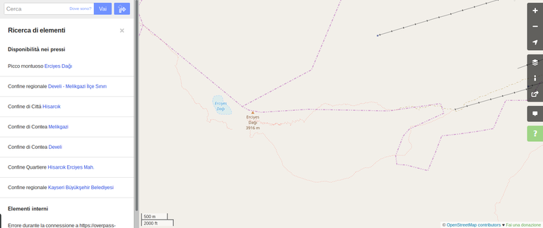
From the main OSM map interface, assuming you are looking at a map of the location you are interested in, the Query Elements tool in the right toolbar (with a "?" icon) can be used to obtain quickly the ID you will input to Pleiades. Continuing on the example above for Argaeus Mons, the screenshot below shows the OSM map with the "?" icon in green on the right.

Click on the "?" icon and the pointer will change shape. Now you can click on the Erciyes Dağı peak to see the associated ID. A list will open on the left.

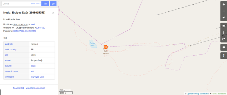
The list shows all map elements in the vicinity. In our case, we are interested in the mountain peak, so the first result is the one to look into detail.

And the node ID is the usually long number after the element name: 2608015053.

