Open Pleiades CSV in QGIS
1. Download the "latest places" dump in Comma-Separated Values format from the "Downloads" page (direct link: http://atlantides.org/downloads/pleiades/dumps/pleiades-places-latest.csv.gz).
NOTE: the pleiades-places-latest.csv file only contains REPRESENTATIVE POINTS (i.e., the centroids of all locations associated with a given place) and RESOURCE TITLES, plus some ancillary information. To get all of the locations (detailed geometry), you must also download the "latest locations" file. To get all of the names for places, you must also download the "latest names" file.
2. Extract (decompress) the gzipped file you downloaded and make a note of where on your hard drive the resulting "pleiades-places-latest.csv" file is to be found.
3. Start QGIS (these instructions have been tested with QGIS 2.18 running under OSX El Capitan 10.11.6).
4. If desired, create a new project.
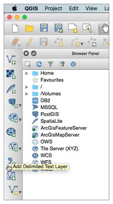
 5. On the "Manage Layers" toolbar, select the "Add Delimited Text Layer" button.
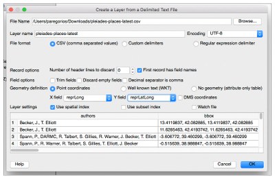
 6. The "Create a Layer from a Delimited Text File" dialog box appears. Ensure that the following fields are set properly:
- File Name (browse to pleiades-places-latest.csv)
- Encoding: UTF-8
- Format: CSV
- First record has field names (check box is selected)
- Geometry definition: point coordinates
- X field: reprLong
- Y field: reprLat
Select the "OK" button.
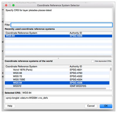
 7. The "Coordinate Reference System Selector" dialog box appears. Select the "WGS 84 (EPSG:4326)" coordinate system and then select the "OK" button.
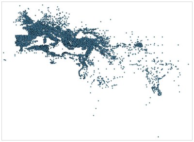
 8. The representative points for all the Pleiades places in the published dataset will appear in the map window in QGIS.
