Getting Coordinates for a Place
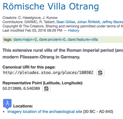
 Pleiades "place resources", e.g. http://pleiades.stoa.org/places/108882, are essentially containers for information about notional places (see further our Conceptual Overview). The maps on each place pull their coordinates from any "location resources" that have been assigned to that place. You'll see links to these under the "Locations" heading. If you click on a location listed there, you'll see information about the associated coordinates (points, lines, polygons), encoded as GeoJSON-format Geometry Objects.
For each Pleiades place resource, we calculate a "representative point" as well. This point -- which is the centroid of all associated locations -- is prominently displayed on the place page and rendered in the map on the place page with a distinctive orange circle. You can easily copy the representative point coordinates by selecting the "copy-to-clipboard" icon that appears immediately after the latitude and longitude coordinate pair under the "Representative Point" heading on the place page.
You can also download all of our data here: http://pleiades.stoa.org/downloads. In the Comma-Separated-Value (tabular) formatted export files, the places table includes "reprLong", "reprLat" and "reprLatLong" columns. These hold the coordinates of the single representative point (centroid) for a place, as described above. If you'd just like a single representative latitude and longitude pair for a place, that's the best data source. But if you want the specific coordinates for each location associated with a place, you'll need to make use also of the "locations" table. The JSON-formatted export files also include both the representative point and the location geometries for each place.
